AlICe

Research →
Teaching →
Media →
Filters : Text[x]
Relics of Electronic Hallucinations. Gazing at Early Computational Fluid Dynamics Drawings from Los Alamos Nuclear Research Center
2024
Rules, A Short History Of What We Live By, A book by Lorraine Daston
2024
From projection to building and vice versa
2023
Emergence of pre-digital algorithmic design
2023
Comparing Randomness
2023
Anthropic Units in Baroque Architecture, the Gallery of the Palazzo Spada and the Roman Palm
2023
Re-presentation as an analytical tool in Baroque Architecture
2022
[x] Crossed Experimentations of Low-Altitude Surveys For The Detection Of Buried Structures
2022
Towards a multi-scale semantic characterization of the built heritage
2021
Jeu d’échelles / échelles du jeu
2021
Perspectiva Virtualis
2021
Exploitation des numérisations pour l'analyse urbaine en contexte archéologique
2020
Urban Planning Representation
2020
Projection built into Sketchpad III: origin of a critical field in computer graphics
2020
Exploitation de numérisations hétérogènes pour la représentation et l'analyse d'un site archéologique de grande échelle : Pachacamac 1532
2019
Relecture de vocabulaires d’architecture : apport de la complexité des représentations numériques dans la caractérisation de formes architecturales
2019
Histoires de Représentation
2019
Building Drawings : Decoding and Recoding the Graphic Projection Algorithm in Architectural Representation
2019
Virtual Systems – Actual Objects: Rendition of Morphosis ' Compositional Principles in the mid 1980s
2018
Jean-Nicolas-Louis Durand’s Clockwork
2018
Le squelette de la Maison du Peuple : hypothèse de restitution 3D
2017
Espaces de processus/Espaces d'analyse. Description graphique de mécanismes géométriques compositionnels et représentationnels. Los Angeles dans les années 1980 : morceaux choisis
2017
Caractérisation de formes architecturales. Une approche expérimentale intégrant complexité et intelligibilité des représentations numériques
2016
Study and Rendition of Jean-Baptiste Hourlier's projection drawings
2016
Morphosis Drawings and Models in the Mid 1980s: Graphic Description of Graphic Thinking
2016
Architecture « résolument » numérique : Paradigm Shift vs. paradigme albertien ?
2015
Reduce to Understand: a Challenge for Analysis and Three-dimensional Documentation of Architecture
2015
Analyse architecturale, modélisation 3D et narration filmique : un regard original sur quelques objets corbuséens
2015
Jean-Nicolas-Louis Durand - Representation as Instrument
2015
Education in Architectural Analysis through Hybrid Graphic Means: a Setup for Critical Thinking
2014
La complexité inhérente aux modèles numériques et le paradigme de la représentation architecturale - Brèves considérations sur les pratiques contemporaines
2012
EXPLORER: A Procedural Modeler Based on Architectural Knowledge
1997

Crossed Experimentations of Low-Altitude Surveys For The Detection Of Buried Structures

Author(s): Alexandre Van Dongen, Peter Eeckhout, David Lo Buglio

Contribution to The International Archives of the Photogrammetry, Remote Sensing and Spatial Information Sciences, 9th International Workshop 3D-ARCH in 3D Virtual Reconstruction and Visualization of Complex Architectures, Mantua, Italy, 2–4 March 2022, vol. XLVI-2/W1-2022, p. 505–512

Abstract

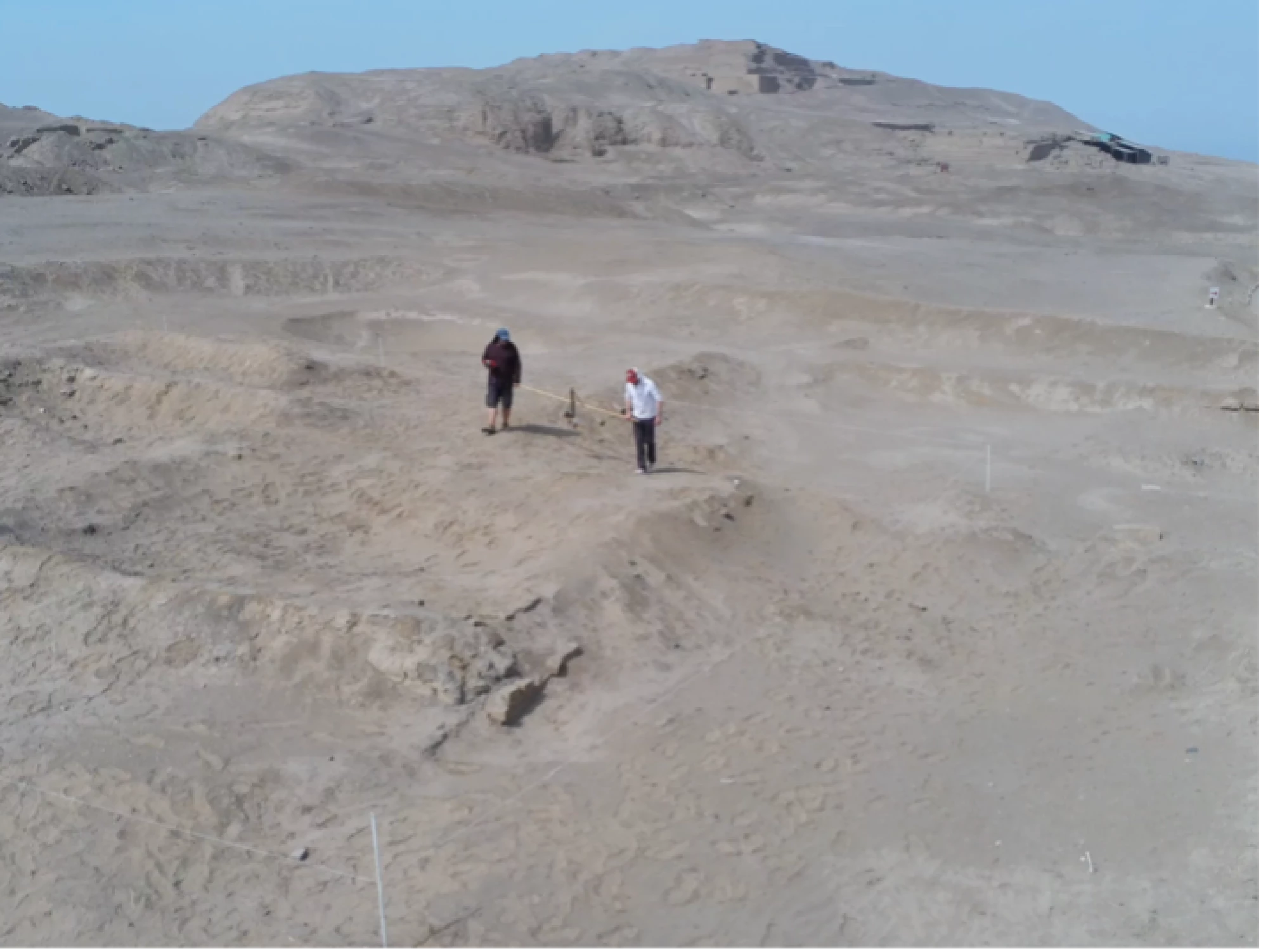
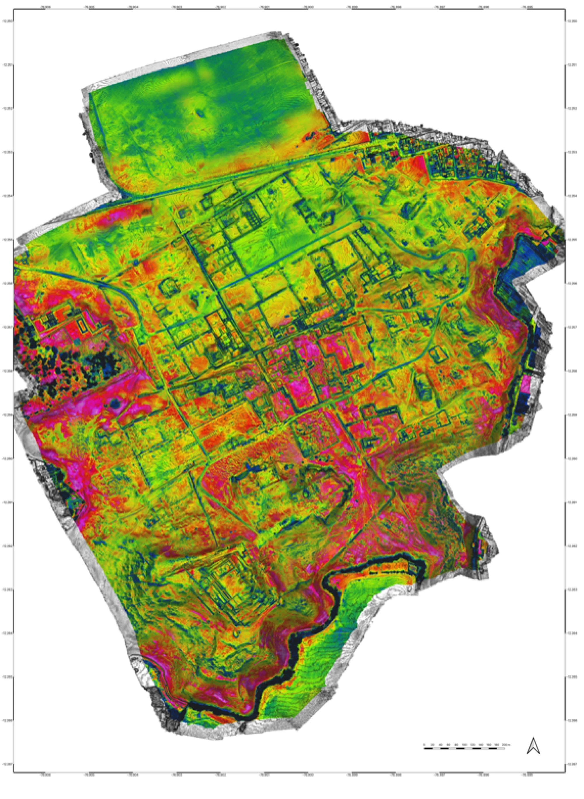
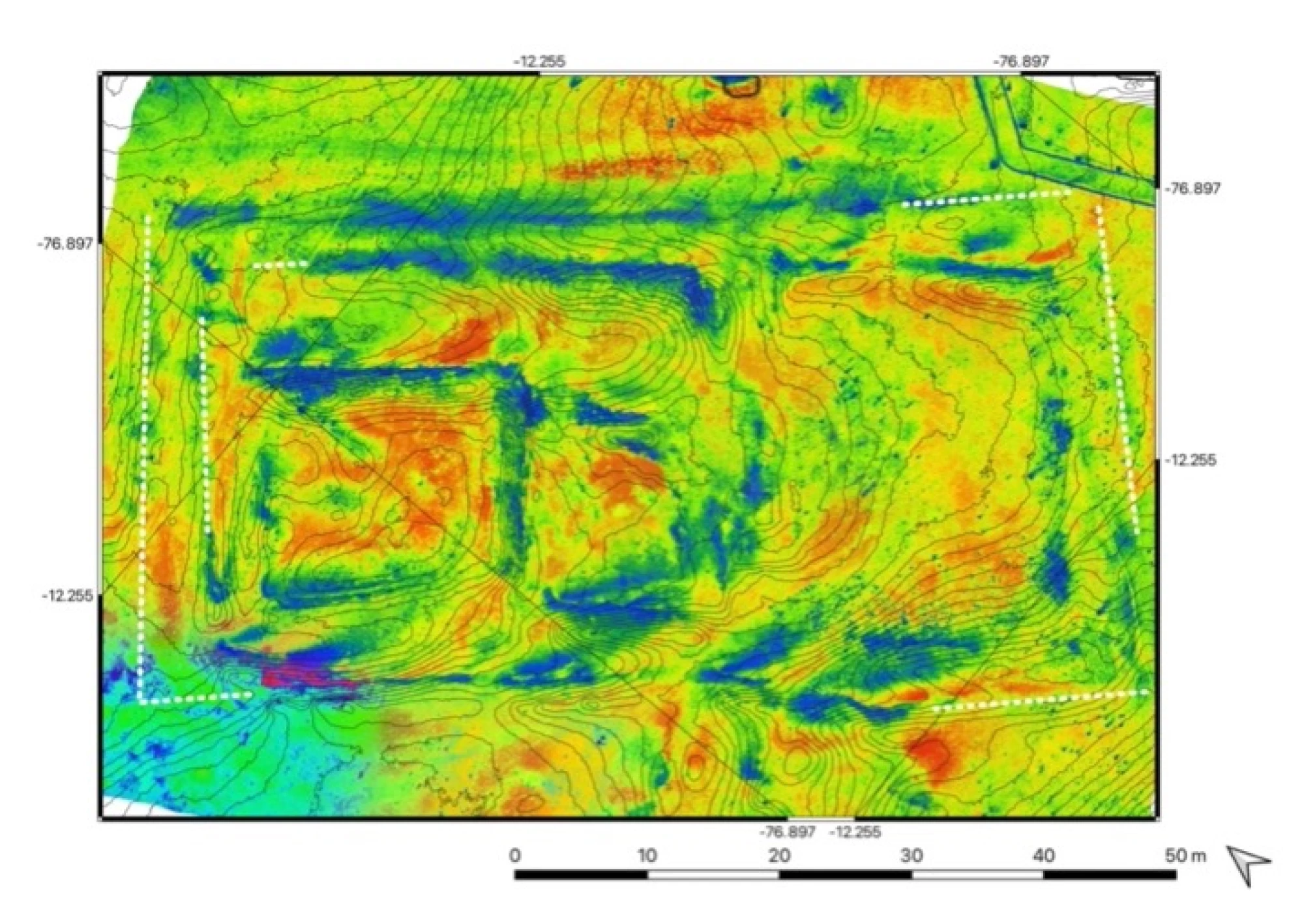
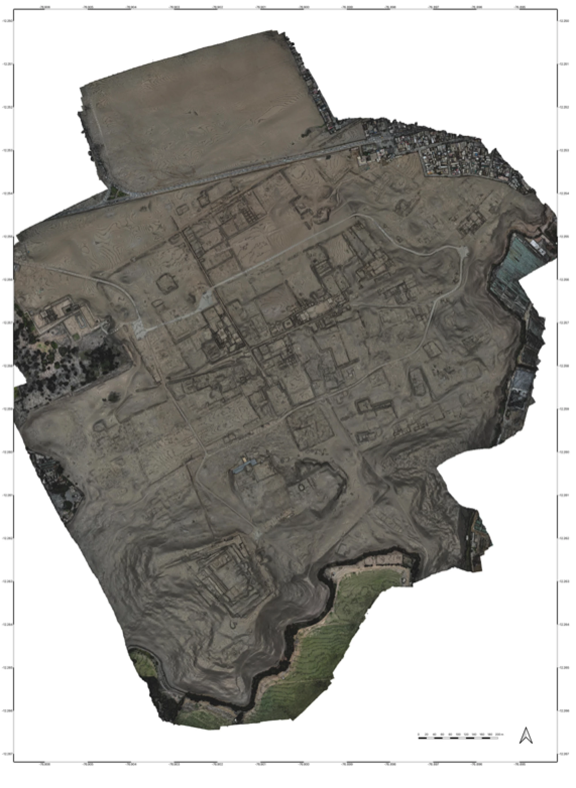
Drones are becoming essential in the field of heritage surveying, especially for large-scale archaeological site. The precision offered by the new survey tools (UAVs, sensors, processing software, etc.) should make it possible to obtain enough information to complete the plan of a site on an urban scale.This paper shows the use of two types of sensors embedded simultaneously on a UAV with the aim of highlighting information that is often difficult to detect on the ground. By crossing RGB and thermal data, certain built-up limits seem to appear. Thanks to this new information, hypotheses of the urban structure are proposed. In other words, the aim is to bring out circulation hypotheses within a large complex archaeological site. Unlike the field of architectural survey where thermography is widely used, for example, to identify certain building pathologies, in archeology this technique does not seem to be part of the traditional survey pipeline and even less on large-scale sites. The possibility of using a third type of sensor is also sketched. The aerial-GPR would in fact make it possible to confirm the presence of a buried structure without having to go through systematic excavation and could provide a three-dimensional image of the ruins.

Link to the full paper